
File:Turkey-CIA WFB Map.png
No higher resolution available.
Turkey-CIA_WFB_Map.png (634 × 324 pixels, file size: 19 KB, MIME type: image/png)
| Description |
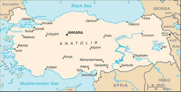
English: A map of Turkey, showing major towns. |
|||
| Date | published 2004 | |||
| Source | CIA, The World Factbook, 2004. | |||
| Author | unknown cartographer | |||
| Permission (Reusing this file) |
|

File history
Click on a date/time to view the file as it appeared at that time.
| Date/Time | Thumbnail | Dimensions | User | Comment | |
|---|---|---|---|---|---|
| current | 09:18, 27 March 2005 | | 634 × 324 (19 KB) | wikimediacommons>Wolfman~commonswiki | {{CIA-map}} |
File usage
There are no pages that use this file.
Global file usage
The following other wikis use this file:
- Usage on miraheze.org
- Usage on mediterraneanvision.miraheze.org
- Usage on miraheze.org
- Usage on wikibigino.miraheze.org
